The Wave-driven Flooding on Reef-lined Coasts Early warning system will provide all coral reef-lined coasts in the world with forecasts for all forms of marine flooding and inundation with the exception of a tsunami. It will also provide information about past flood and inundation events.

How does it work?
WaveFORCE will combine satellite data, hydrodynamic models and reef profiles to produce 241 flood forecasts stretching out to 10 days into the future, updated 4 times per day, for each point, at intervals of 200 meters for every coral reef-lined coast in the world. Usually, this would require multiple super computers that would be extremely costly to run and maintain. However, the scientists at WaveFORCE team have come up with a brilliant solution to this seemingly intractable problem.
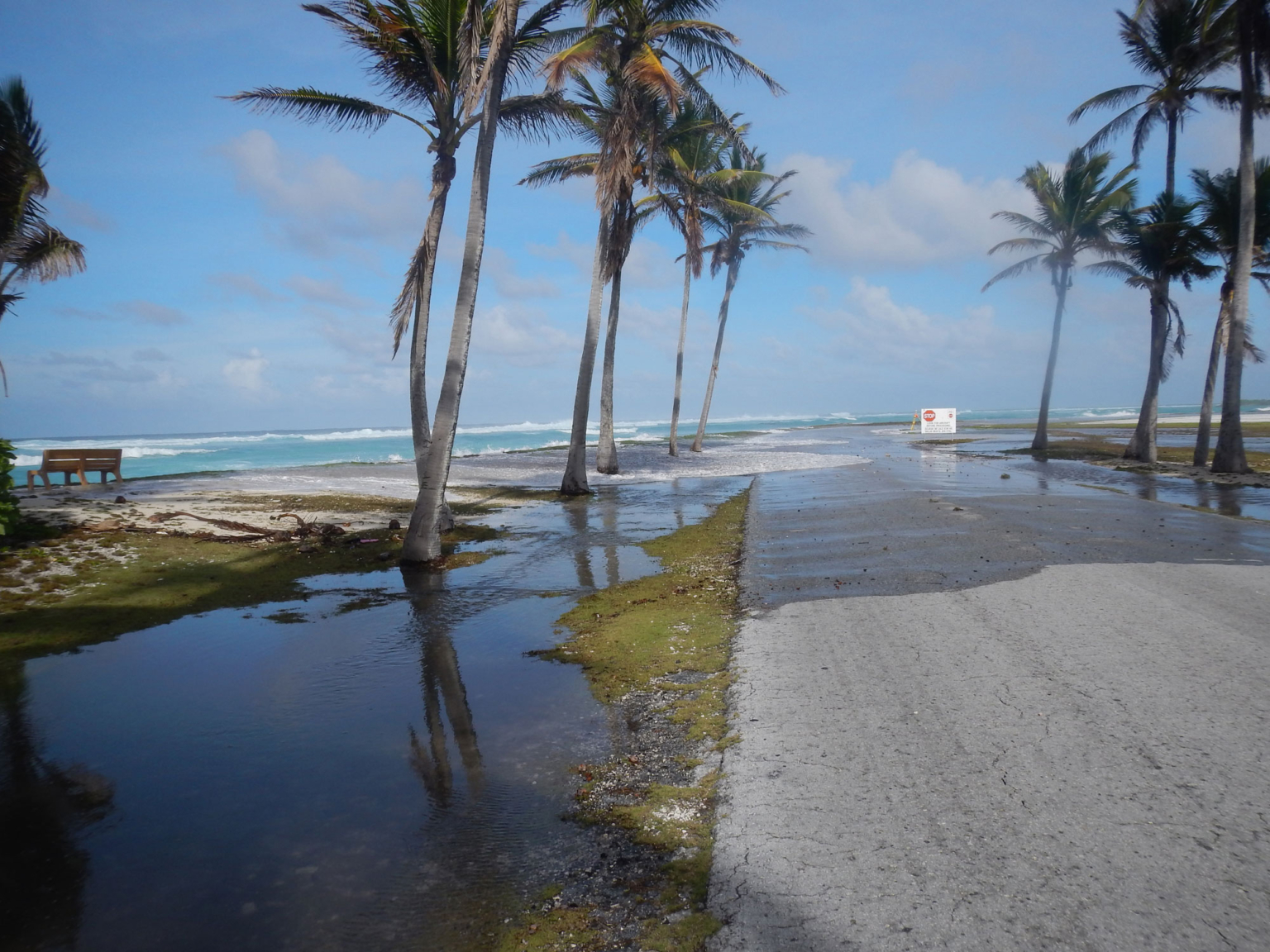
WaveFORCE forecasts for all forms of marine flooding and inundation with the exception of a tsunami for a total of 82 countries, including 43 UN Small Island Developing States (SIDS)

Who will benefit?
ABOUT US
Flooding is where water temporarily covers normally dry land, whereas inundation is where water permanently covers normally dry land. Marine flooding can be causes by very high tides, swell waves, storm surge, tsunamis or a combination of these. Inundation is primarily a result of sea level rise due to climate change, although it can also be caused by land subsidence. Climate change is also affecting the frequency and severity of storms, as well as other sea level related factors such as the strength of ENSO events (and other similar events such as the Indian Ocean Dipole and the Atlantic Ocean Oscillation), the strength of trade winds, etc., all of which contribute to an increased frequency and severity of marine flood events.
Many low-lying coasts and islands with coral reefs are experiencing marine flood events that strike with little to no warning. These events are occurring with ever increasing frequency and severity. They are a result of a combination of sea surface elevation and wave height, and can cause severe flooding even on windless, sunny days.
The provision of marine flood forecasts is an important tool for increasing the resilience of coastal communities while decreasing the risk to them, allowing these people to maintain their way of life and to continue to live in these locations.
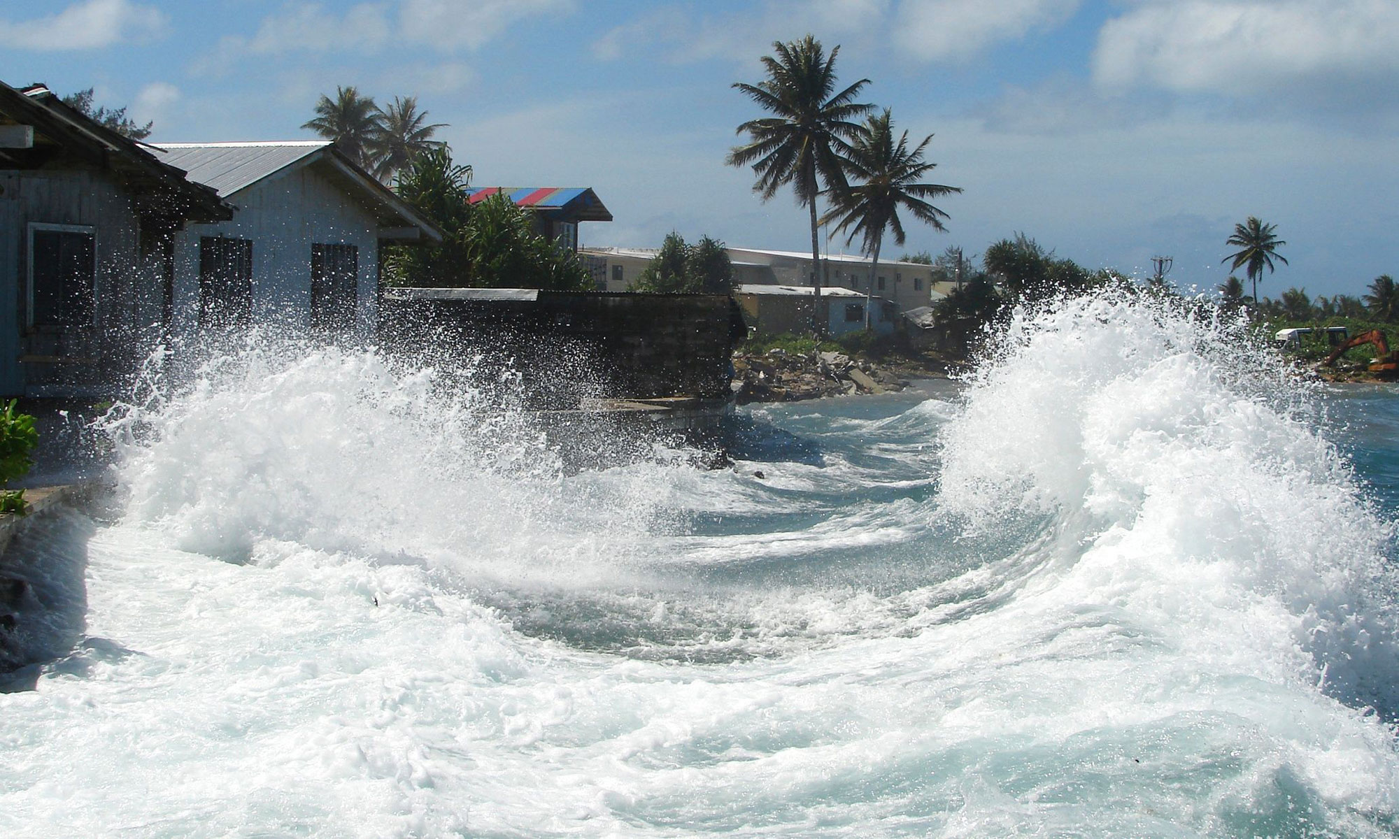
Currently marine flood forecasts do not exist for most of the world’s coral reef lined coasts. Therefore, there is a very real need along these coasts for a tool that is able to predict the timing and severity of marine flooding events. Without this tool, coastal communities are vulnerable to:
- Loss of life from drowning.
- Loss of, and damage to property and infrastructure.
- Decreasing viability of communities via loss of, and damage to crops, fishing (via decreased water quality and wave damaged reefs), and freshwater resources.
- Reduction of livable land due to increased erosion, salt intrusion, and frequent and/or permanent inundation.
WaveFORCE’s main goal is to provide the data and information necessary to design and implement the various solutions crucial to help small island states and their communities to be resilient to marine flooding.

How does it work?
By combining satellite data, hydrodynamic models, and reef profiles, WaveFORCE can provide flood forecasts for every coral reef-lined coast in the world, updated four times a day and at intervals of 200 meters.
To achieve this level of accuracy and coverage, WaveFORCE relies on a sophisticated, high-resolution model that needs to be run at every point throughout the world, 964 times a day. This would typically require multiple supercomputers, which would be prohibitively expensive to operate and maintain. However, the WaveFORCE team has found a ground-breaking solution to this challenge. Using a computer with considerable computing power, they have pre-calculated all the necessary data by running hundreds of thousands of combinations of wave height, sea surface elevation, and reef profiles through a high-resolution model called X-Beach. The resulting data have been incorporated into an intelligent spreadsheet that can be quickly accessed and analysed, allowing WaveFORCE to provide accurate flood forecasts using a large PC, rather than a supercomputer.
The BEWARE model lies at the heart of the WaveFORCE system. Tested on coral reef-lined coasts using fully implemented X-Beach models, BEWARE has proven to have an 8% error rate in predicting wave run-up, compared to X-Beach. The tests were conducted at 36 different coastal sites across eight regions, with each site representing a different reef profile. By simulating a wide range of wave heights, periods, and sea levels, the WaveFORCE team has demonstrated that the system can accurately predict floods at sites throughout the world.
With its unprecedented coverage and accuracy, WaveFORCE is set to revolutionize flood forecasting and help communities worldwide better prepare for and respond to natural disasters.
OUR TEAM
WaveFORCE was conceived by the three members of National Oceanic and Atmospheric Administration (NOAA), United States Geological Service (USGS) and Deltares.
Meet the WaveFORCE team:
Dr. Curt Storlazzi
Dr. Robert McCall
Dr. Ap van Dongeren
Dr. William Skirving
WaveFORCE is also supported by the following institutions and groups:



FLOOD FORECAST VIEWER
Welcome to the WaveFORCE Flood Forecast Viewer tutorial! Please note that while the viewer may not be perfect, it serves as a useful tool to help understand what the WaveFORCE user interface might look like. We are committed to continue to improve the viewer and making it more user-friendly.
As WaveFORCE will have global coverage, it is important that the flood forecast information is accessible to a diverse range of people with vastly different cultural and educational backgrounds. Therefore, we may need to develop more than one version of the viewer and come up with novel ways to present some of the information.
To ensure that the WaveFORCE Flood Forecast Viewer is fit for purpose, we will be conducting a series of workshops that allow every country in the WaveFoRCE user community to input their ideas and needs into the design of the viewer. Your feedback is essential to making sure the viewer is accessible and user-friendly for everyone.
Thank you for using the WaveFORCE Flood Forecast Viewer, and we look forward to improving it with your help.
